
USGS Geologists Study Debris-Flow Aftermath in Montecito
USGS geologists join team to provide science support following Montecito post-fire debris-flow event.
Days after fatal debris flows devastated Southern California’s Montecito community, a team of U.S. Geological Survey geologists joined county, state, and federal partners to survey and evaluate the aftermath.
Days after fatal debris flows devastated Southern California’s Montecito community, a team of U.S. Geological Survey geologists joined county, state, and federal partners to survey and evaluate the aftermath. Commonly known as mudslides or mudflows, debris flows are slurries of water, rock, soil, vegetation, and boulders with the consistency of wet concrete that can move rapidly downhill and down channel.
USGS geologists from the Landslide Hazards Program and Earthquake Science Center deployed to Santa Barbara County to support a geohazard assessment of the Montecito area; led by the California Geological Survey, with the support of the California Department of Forestry and Fire Protection (CAL FIRE).
“We’re mapping the area that’s been inundated by debris flows so that we are able to get some sense of the spatial extent of the area debris flows impacted, as well as the magnitude of the flows,” said USGS geologist Dennis Staley. “We will also be able to produce a forensic reconstruction of what happened throughout the event.”
Based on the information the group collects from the area, they can estimate the velocity and other dynamics of the flow to better understand and forecast how similar events might behave in the future.
Real-time Techniques Help to Monitor Hazards
The Dec. 4, 2017 Thomas fire, Southern California's largest wildfire on record, burned more than 280,000 acres across Ventura and Santa Barbara counties for nearly a month. After the wildfire, the USGS completed a Post-Fire Debris-Flow hazard assessment to determine debris-flow susceptibility.
The hazard assessment uses information on burn severity, topography, and soil characteristics to estimate the likelihood and volume of debris flows in response to a design storm. The maps need to be created rapidly after the fire, but before the first storm, in order to provide as much time as possible to develop emergency response plans. The maps are also used by the National Weather Service offices in southern California to inform debris-flow and flash-flood alerts.
“In this case, the maps showed that many drainages across the fire are highly susceptible to debris flows even during a garden-variety storm,” said USGS hydrologist Jason Kean. “The burst of rain that triggered the debris flows was more than three times greater than the design storm that was used to create the maps.”
According to the maps, the Montecito area, as well as other parts of the Thomas Fire, may remain susceptible to flooding and debris for the next two years.
Weeks after the fire, which destroyed thousands of structures, heavy rainfall eroded the burned areas — saturating the Montecito community with between 3-5 inches of rain.
Areas of steep topography subjected to intense rainfall, following a large fire, are particularly susceptible to damaging debris-flow episodes.
Debris flows can start on steep hillsides as shallow landslides that liquefy and accelerate to speeds that are typically about 10 mph, but can exceed 35 mph. However, in recently burned areas, debris flows may also initiate from erosion on hillsides and from stream channels. The flows then reach canyon mouths or flatter ground, where the material spreads over a broad area, sometimes accumulating in thick deposits that can wreak havoc in developed areas.
“Post-fire debris flows are particularly hazardous because they can occur following very short bursts of intense rainfall,” said Jonathan Godt, USGS Landslide Hazards Program Coordinator. “Because debris flows move fast with great momentum they, can strip vegetation, block drainage ways, damage structures, and endanger human life.”
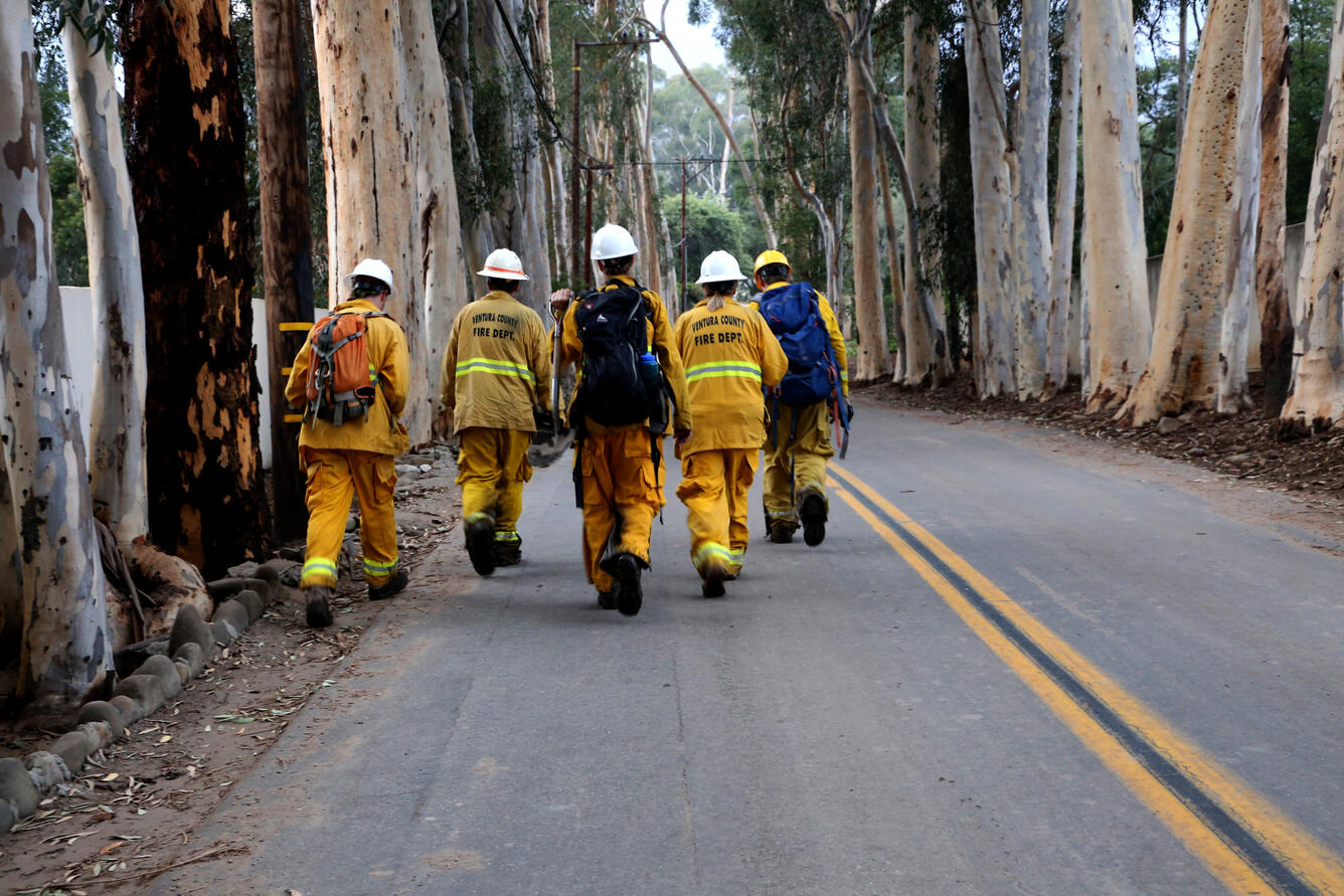
Boots-on-Ground Evaluations
Among the remains of demolished infrastructure, the team of scientists trudged through miles of thick, deep mud, rubble and wreckage to map the edges of the flow. They recorded flow features such as deposit thickness, size of boulders and inundation depth on GPS-connected electronic tablets. The location data are used to help emergency responders and will be used to model the flow.
After a debris flow event, satellite imagery helps document the scope of the event, but in order to provide the best data to emergency responders and to learn from this event, scientists must physically canvass the scene.
“It’s important for scientists to be in the field shortly following the debris flow to collect perishable measurements of the depth, character and perimeter of the debris flows,” said research geologist Dr. Kate Scharer. “By working on the ground, we can evaluate the features that influence how the debris flow spreads across the land and then use these data in models to inform federal, state and local partners how future events can unfold.”
For this project, the scientists were also focused on understanding how the terrain controlled the path of the debris flows, and how the area inundated by the debris flow deposits was different or similar than what was estimated using flood models.
Partner Collaborations Advance Hazard Understanding
Understanding and mapping post-fire debris flow inundation serves multiple objectives for all organizations involved.
The partnership between Santa Barbara County, CAL FIRE’s Watershed Protection Program, the disaster incident command, CGS and USGS, will meet immediate and long-term needs.
After the team identifies areas that were inundated by the January 9, 2018 event, as well as areas that could be inundated in future, the data collected now will be used in a long-term effort to develop models of debris-flow runout and inundation.
“This effort assists Santa Barbara County and the State of California with additional tools to map post-wildfire landslide hazards in areas at risk,” said Jeremy Lancaster, CGS Regional Geologic Mapping Program Manager. “The results of this information can also be used in post-wildfire hazards evaluations and risk reduction efforts in California, and may be broadly applicable to large regions of the United States.”
More Resources & Information
Post Wildfire, Flash Flood and Debris Flow Guide
Debris Flow Hazard in The United States
Emergency Assessment of Post-Fire Debris Flow Hazards
Southern California Landslides: An Overview
Southern California—Wildfires and Debris Flows
Real-time Monitoring for Potential Landslides
What To Do and Look For During and Immediately After Heavy Rains
Get Our News
These items are in the RSS feed format (Really Simple Syndication) based on categories such as topics, locations, and more. You can install and RSS reader browser extension, software, or use a third-party service to receive immediate news updates depending on the feed that you have added. If you click the feed links below, they may look strange because they are simply XML code. An RSS reader can easily read this code and push out a notification to you when something new is posted to our site.